You call a surveyor, expect a simple quote, and the number comes back higher than you planned for. That happens a lot. Boundary survey cost isn’t based on how big your house is or how long the job takes in the field. It’s based on how much research, documentation and legal precision the job requires before anyone sets foot on your property. Once you understand what goes into it, the price makes sense
What You’re Actually Paying For
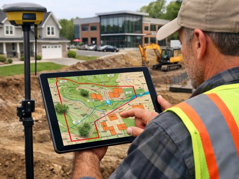
Most people think a boundary survey is just someone walking around with equipment and marking corners. That’s the last hour of the job.
The bulk of the work happens before the crew arrives. A licensed surveyor has to research your deed, pull prior survey records, check county plat maps and trace the chain of title. For older properties, that process alone can take days.
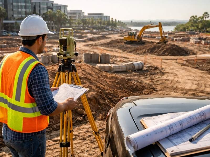
After the field work, the data has to be processed, checked and compiled into a certified legal document. The surveyor signs and seals it. That signature carries professional liability. If the survey is wrong, the surveyor is on the hook.
You’re not paying for stakes in the ground. You’re paying for legal accuracy and the professional responsibility behind it.
The Factors That Push Boundary Survey Cost Up
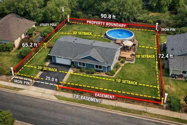
Lot Size and Shape
Larger lots take longer to survey. That part is obvious. What’s less obvious is that irregular lot shapes add more complexity than size alone. A standard rectangular lot with four corners is fast to close. An oddly shaped parcel with six or eight corners, curved boundaries or angular lines takes considerably longer to measure and verify.
Waterfront parcels are a separate category. When a boundary follows a natural feature like a shoreline or canal, the legal line doesn’t always match what you can see. That requires extra research and field verification.
Age of the Property Records
Older properties often have thin or inconsistent records. Deeds written decades ago used vague language. Plat maps from early subdivisions were drawn by hand and don’t always match what’s on the ground today.
When records are unclear, the surveyor has to do more work to establish what the legal boundary actually is. That means more title research, more time reviewing conflicting documents and sometimes consultation with neighboring property owners or their surveyors.
New construction in well-documented subdivisions costs less to survey. A 1940s bungalow with a metes and bounds deed in a neighborhood that’s been subdivided three times since then costs more.
Missing or Disturbed Monuments
When a surveyor locates your property corners, they look for existing physical monuments, which are iron pins, concrete markers or survey stakes set by a previous surveyor. If those monuments are missing, moved or destroyed, new ones have to be set.
Setting monuments requires extra field time. It also requires the surveyor to calculate positions from scratch using surrounding evidence. Neighbors’ fences, adjacent survey records and deed calls all factor in. This adds hours to the job.
Dense Vegetation and Difficult Terrain
A crew working a clear, flat lot moves fast. A crew working through overgrown brush, standing water or sloped terrain moves slowly. Line-of-sight is the foundation of survey measurements. When vegetation blocks it, crews spend time clearing or working around it.
Properties with heavy vegetation, canal frontage or irregular drainage features cost more to survey than a clean suburban lot on dry ground.
Urgency
Rush jobs cost more. If you need a certified survey in 48 hours for a closing that moved up, expect to pay a premium. Most surveys take one to three weeks under normal conditions. Compressing that timeline means pulling a crew off other work and accelerating the office processing. That has a price.
Why Urban Markets Cost More Than Rural Areas
Boundary survey cost in dense urban markets typically runs higher than rural or suburban areas. A few reasons drive that gap.
Dense urban development means more existing improvements to document. Easements are more common and more varied in older subdivisions. County permit records are more layered and complex. On top of that, demand in high-volume markets is consistently strong, and surveyors price accordingly.
A standard residential boundary survey typically falls between $500 and $2,000 for most lots. Larger, irregular or waterfront parcels go higher.
What Doesn’t Affect the Price (But People Assume It Does)
The value of your property has no effect on survey cost. A $2 million lot and a $300,000 lot of the same size and shape cost roughly the same to survey.
How long you’ve owned the property doesn’t matter either. A property you bought last year with a recent survey on file may actually cost less to resurvey than a property with a 30-year-old survey and missing monuments.
How to Get an Accurate Quote
Don’t accept a quote based on square footage alone. A good surveyor asks specific questions before pricing the job. They’ll want to know:
- The legal description from your deed
- Whether an existing survey is on file and how old it is
- The type of survey needed (boundary, ALTA, elevation certificate)
- The intended use (permit, closing, dispute resolution)
- Your timeline
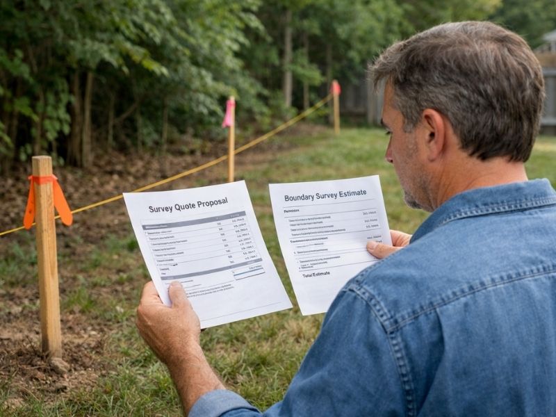
If a quote comes back without any of those questions being asked, it’s probably not accurate. You’ll either get an inflated number or a low quote that climbs once the surveyor sees the actual records.
Get at least two quotes. Ask both surveyors to break down what’s included. Compare scope, not just price.
Frequently Asked Questions
Why does boundary survey cost vary so much between properties?
Cost varies because each property has different research requirements, field conditions and record complexity. A newer home in a documented subdivision with intact monuments takes less time to survey than an older parcel with a metes and bounds deed, missing corners and unclear prior records. Lot size, shape, vegetation and terrain all factor in as well.
Does a higher property value mean a higher survey cost?
No. Survey cost is based on the work required, not the value of the land. Two properties of the same size and complexity cost roughly the same to survey regardless of market price. Location affects cost through labor rates and regional demand, but appraised value doesn’t.
What is included in a standard boundary survey?
A standard boundary survey includes title and deed research, location of existing monuments, field measurement of all boundary lines, comparison of measurements against the recorded legal survey, setting of new monuments where old ones are missing and a certified survey drawing signed and sealed by a licensed Professional Surveyor and Mapper.
Can I use an old survey instead of getting a new one?
Sometimes. Lenders and title companies set their own requirements, and many will not accept a survey older than one to five years. If monuments have moved, if adjacent parcels have changed or if the property has been modified since the last survey, a new one is required. Always confirm with your lender and title company before assuming an existing survey is acceptable.
What makes a waterfront property cost more to survey?
Waterfront and canal properties often have boundaries that follow natural features like shorelines or mean high-water lines. Those legal boundaries require extra field verification and may not match visible physical features. Easements and riparian rights add another layer of research. Combined, these factors increase both field time and office processing time.