↓
 

Miami Land Surveying

Local Land Surveyors in Miami, FL

Miami Florida Land Surveying
(305) 376-7707
Miami Land Surveying
  • Home
  • ALTA Survey
  • Boundary Surveying
  • Construction Survey
  • Drone LiDAR Mapping
  • Elevation Certificate
  • Land Surveying
  • Topographic Survey
  • About Us
  • Blog
  • Contact Us
Home→Author MiamiLS - Page 3 << 1 2 3 4 5 … 10 11 >>

Author Archives: MiamiLS

Post navigation

← Older posts
Newer posts →

How to Review a Drone Survey Proposal Before You Sign It

Miami Land Surveying Posted on May 21, 2026 by MiamiLSMay 19, 2026
Drone capturing aerial mapping data over a development site with terrain analysis, survey plans, and mapping technology

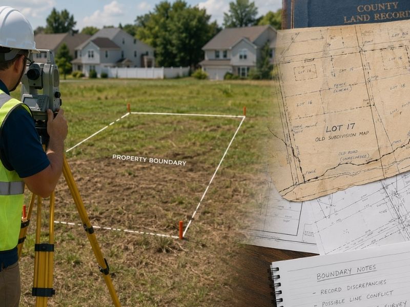
Before you sign a drone survey proposal, read past the price. Most developers don’t, and it costs them. A drone survey that looks clean on paper can produce outputs a county rejects, a lender won’t accept or a permit office sends back for recertification.

You don’t need to be a pilot to review a drone survey contract well. You need to know which things to check and what to do when they’re missing.

What a Drone Survey Proposal Should Always Include

A solid proposal covers more than scope and price. Before comparing quotes, confirm each proposal answers these questions clearly:

  • What sensor will be used (camera or LiDAR)?
  • What flight altitude is planned?
  • Will ground control points be placed on site?
  • Is RTK or PPK positioning included?
  • Who will certify the final survey output?
  • What file formats will you receive?

If a proposal skips any of these, ask. A firm that can’t answer clearly is already telling you something.

Photogrammetry or LiDAR: Why the Method Matters

These are the two main methods used in drone surveys. They’re not interchangeable.

Photogrammetry stitches together hundreds of overlapping photos into a 3D model. It works well on open sites with clear ground visibility. It’s also less expensive than the alternative.

LiDAR sends laser pulses at the ground and measures how long they take to bounce back. It penetrates tree canopy and dense vegetation to reach bare earth below. For wooded or heavily vegetated sites, that’s the only method that gets you accurate terrain data.

If your site has significant vegetation and the proposal only mentions photogrammetry, ask why. On the wrong site, photogrammetry produces a model of the treetops, not the ground you’re building on.

What “Accuracy” Actually Means in a Drone Survey Proposal

This is where proposals get vague fast.

A drone survey using RTK positioning and proper ground control can hit horizontal accuracy of 1 to 3 centimeters. That’s survey-grade. Without ground control, standard GPS gives you 1 to 3 meter accuracy. That fails most permit reviews. Commercial lenders won’t accept it either.

Look for these terms in the proposal:

  • RTK or PPK positioning (centimeter-level accuracy)
  • GCP-verified (confirms ground control was used)
  • Standard GPS only (not survey-grade, ask why)
  • “Sub-foot accuracy” with no positioning method named (too vague, ask for specifics)

If the proposal doesn’t name the positioning method, close that gap before you sign.

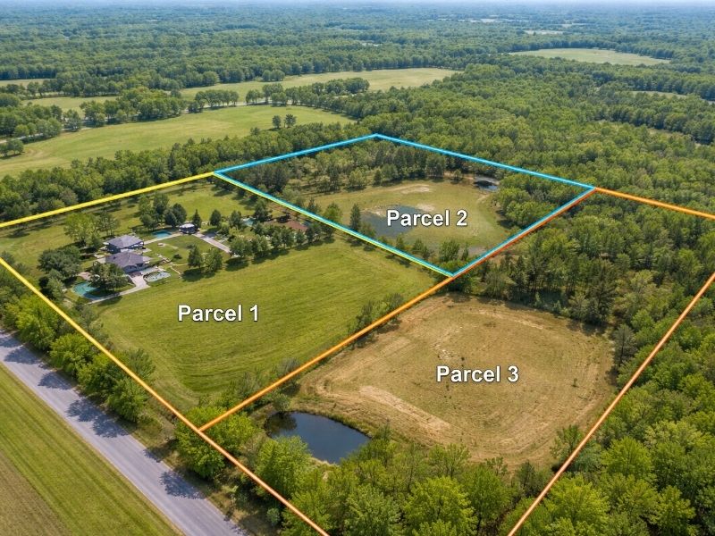
Ground Control Points: The Line Item Many Proposals Skip

GCPs are physical targets placed on the ground before the drone flies. The surveyor measures their exact coordinates, then uses them to verify and correct the drone data during processing.

Without GCPs, even an RTK drone can drift by several feet across a large site. The error tends to concentrate at site edges, which is exactly where boundary and setback calculations matter most.

A complete proposal tells you:

  • How many GCPs will be placed
  • How they’ll be distributed across the site
  • How they’ll be measured (total station, GPS rover or NTRIP network)

One GCP per 20 to 30 acres is a reasonable standard for most topographic surveys. ALTA-grade work requires more. If the proposal mentions zero GCPs and your project involves permits or construction staking, get a clear explanation before moving forward.

Who Certifies the Final Output?

This is the question most developers never ask. It’s also the most important one.

An FAA Part 107 certificate lets someone fly a drone commercially. It does not qualify them to certify a survey. In most states, any survey output used for legal purposes, permit filings or construction must be signed and sealed by a licensed Professional Land Surveyor (PLS or RPLS).

Check the proposal for one of these:

  • A named licensed surveyor who will review and stamp the output
  • A statement that the output will be certified by a PLS
  • Reference to state licensure or compliance with ASPRS accuracy standards

If the proposal comes from a drone-only company with no licensed surveyor listed, the output may not be usable for your purpose. Confirm this before you pay.

If your project sits in a flood zone, also ask whether the licensed surveyor on the team can prepare an elevation certificate. That’s a separate document, but the same certified surveyor handles both. 

What Files You’ll Actually Receive

A drone survey can produce several different output types. Not all firms include all of them by default and some charge extra for specific formats.

Common outputs include:

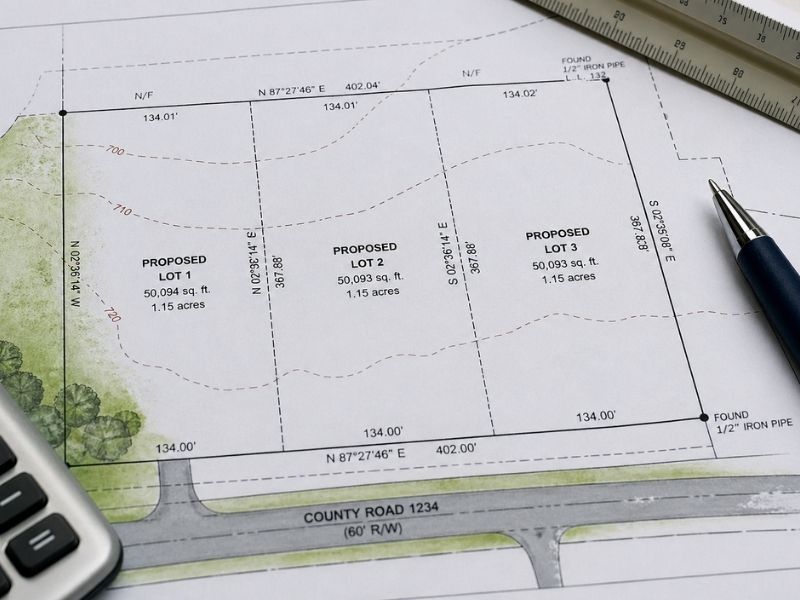
  • Orthomosaic map: a geometrically corrected aerial image of the full site
  • Point cloud: a 3D dataset of millions of measured points across the terrain
  • Digital Terrain Model (DTM): shows only the bare earth surface, used for grading and drainage design
  • Digital Surface Model (DSM): includes everything above ground, including trees and structures
  • Contour lines: derived from the DTM, used in civil engineering and site planning

Know what your engineers and permit office need before you accept a proposal. If the proposal only mentions an orthomosaic and your civil engineer needs a DTM for drainage design, you’re going back for more work.

Red Flags to Spot Before You Sign

These items in a proposal should make you slow down.

No positioning method named. RTK, PPK or standard GPS should be stated clearly. Vague accuracy claims without a named method are a warning.

No GCPs on a large or vegetated site. RTK alone isn’t enough for survey-grade accuracy on complex terrain.

No licensed surveyor listed. If the output needs to be certified and no PLS is named, the output may be unusable for your application.

Unusually fast turnaround. Most quality drone surveys with proper processing take 1 to 3 weeks. A 48-hour promise on a large site is worth questioning.

Output formats not specified. You need files your civil software can actually open. Confirm this before signing.

Questions to Ask Before You Sign

Run through this list before approving any drone survey proposal:

  • What sensor are you using and why is it right for my site?
  • What positioning system do you use, RTK or PPK?
  • How many GCPs will you place and how will they be measured?
  • Will a licensed surveyor certify the final output?
  • What file formats will I receive and are they compatible with my civil software?
  • What’s the turnaround from authorization to final delivery?
  • What can delay that timeline?

Direct answers tell you whether the firm knows what they’re doing. Vague answers tell you the same thing, just the other way around.

Frequently Asked Questions

What should a drone survey proposal always include?

A complete proposal should state the sensor type (photogrammetry or LiDAR), the positioning method (RTK or PPK), whether GCPs will be placed, who will certify the final output and what file formats you’ll receive. Any proposal missing these details needs clarification before you sign.

Does a drone survey need a licensed surveyor?

In most states, yes, if the output will be used for permit filings, legal purposes or construction. An FAA Part 107 certificate allows someone to fly commercially but does not authorize them to certify a survey. Look for a named licensed Professional Land Surveyor in the proposal.

What is the difference between RTK and standard GPS in a drone survey?

RTK corrects GPS data in real time using a base station or network correction service and achieves centimeter-level accuracy. Standard GPS without correction gives 1 to 3 meters of accuracy, which is not suitable for survey-grade work or permit submissions.

What are ground control points and do I need them?

Ground control points are physical targets placed on site before the drone flies. A surveyor measures their exact coordinates and uses them to verify the drone data after processing. They’re standard practice on most sites where survey-grade accuracy is required.

How long does a drone survey take?

Most standard drone surveys take 1 to 3 weeks from authorization to final output. LiDAR surveys and large commercial sites take longer due to added field work and processing. Always get a written timeline before signing.

Posted in land surveying | Tagged drone mapping, drone survey

What to Look for When Hiring a Land Surveyor

Miami Land Surveying Posted on May 20, 2026 by MiamiLSMay 19, 2026
Land surveyor locating property boundaries while reviewing land records, plat maps, and survey documents for site planning

When hiring a land surveyor, most developers get one quote, maybe three, then pick the lowest. That decision costs more than they expect.

A bad survey doesn’t just need correcting. It can void permits, create title problems and spark boundary disputes that stop a project cold. The money saved on the cheap hire won’t cover what comes next.

Here’s what to check before you sign anything.

Why This Hire Is Different

A survey carries legal weight. It gets recorded. Lenders rely on it. Title companies base coverage decisions on it. When something is wrong, fixing it mid-project is expensive and slow.

Most contractors can be swapped out if things go sideways. A surveyor’s work is already filed with the county before you realize there’s a problem.

What to Look for When Hiring a Land Surveyor

1. Confirm They Hold an Active State License

Every state requires land surveyors to be licensed. Before anything else, verify the license is current and valid in the state where your project sits.

Most state licensing boards have a free public lookup tool online. Use it. The license number should also appear on every official survey drawing they produce. If someone won’t give you that number upfront, stop the conversation there.

2. Match Their Experience to Your Project Type

Land surveying covers a wide range of work. A firm that handles residential lot splits all day may not be the right fit for an ALTA/NSPS survey your commercial lender requires. Someone who specializes in topographic surveys may not have deep experience with construction staking.

Ask directly: what types of surveys do you do most often? If your project type isn’t the bulk of their work, keep looking.

3. Ask How Much They Know Your County

When you search for land surveyors near me, local knowledge is exactly what you’re paying for. 

This matters more than most developers expect. County records vary. Older plats can be inconsistent. Local municipalities have their own quirks around how they handle permits, easements and right-of-way documentation.

A surveyor who knows your county well spots problems faster. They know which records are digitized and which require a physical records search. They know the local examiners. That familiarity saves real time on complex projects.

Ask how many projects they’ve completed in your specific county. A vague answer usually means not many.

4. Get the Full Scope in Writing Before You Hire

Before you authorize any work, know exactly what you’re getting and when.

Your written scope should cover:

  • The type of survey being performed
  • What the final survey package includes (signed and sealed drawing, CAD files, written report)
  • The turnaround time from authorization to delivery
  • What can extend that timeline and what happens when it does

A professional surveyor should answer all of this without hesitation. Vague answers at the quote stage are a preview of how the job will run.

5. Ask for Proof of E&O Insurance

E&O stands for errors and omissions. It’s professional liability coverage that protects you if a mistake in the survey causes financial damage to your project.

Ask for a certificate of insurance before signing. Any reputable firm will provide it without pushback. If they can’t, that’s not a firm worth hiring.

6. Call References From Similar Projects

Ask for two or three references from projects that match your scope in type and size. Then call them.

Ask whether the survey came back on time. Ask whether what they received matched what was promised. Ask whether any problems came up and how the firm handled them. One honest conversation with a past client tells you more than any sales pitch.

Red Flags That Should End the Conversation

Some problems aren’t obvious from a license check. Watch for these:

A quote that’s far below everyone else. Low quotes usually mean something is missing from the scope, the timeline is unrealistic or research time is being cut. You’ll find out which one it is after you’ve already paid.

Slow communication before the contract is signed. If they’re hard to reach now, they’ll be harder to reach when you’re waiting on a drawing that’s holding up your permit.

No clear answer on what the final survey includes. A professional knows exactly what they’re producing. Hesitation here is a real problem.

No license number or E&O insurance provided. These are non-negotiable. Walking away is the right call.

Questions to Ask Every Surveyor You Vet

Run through this list before hiring anyone:

  • Are you currently licensed in this state? What’s your license number?
  • What types of surveys do you do most often?
  • How much work have you done in this county?
  • What exactly will I receive when the job is complete?
  • How long will this take from authorization to delivery?
  • Do you carry E&O insurance? Can I see proof?
  • Can you provide references from projects similar to mine?

Short, direct answers are what you’re looking for. A surveyor who stumbles on these questions is probably not ready for your project.

Frequently Asked Questions

How do I verify a land surveyor’s license?

Search for your state’s board of professional land surveyors online. Most maintain a free public database where you can confirm a license is active and in good standing. The license number should also appear on any official survey drawing the firm has produced.

Does a lower quote mean lower quality?

Often, yes. Low quotes usually reflect cuts in research time, field work or what’s included in the final package. A survey error that requires a correction, or that causes a permit rejection, will cost more to fix than the difference between quotes.

What is E&O insurance and why do I need it?

E&O is professional liability insurance. It covers financial losses caused by errors in the surveyor’s work. If a boundary call is wrong and it affects your project, E&O coverage is how you recover damages. Always ask for proof before you sign a contract.

Do I need a different surveyor for different project types?

Not always, but the experience match matters. An ALTA/NSPS survey required by a commercial lender has different standards than a simple boundary survey for a lot split. Make sure the firm regularly completes the specific type of survey your project requires.

How long does a land survey take?

Most standard surveys take 1 to 3 weeks from authorization. ALTA surveys and larger commercial projects take longer because of the added research and field work involved. Get a written timeline before you hire and ask what can cause it to slip.

Posted in land surveying | Tagged Land Surveying, land surveying miami, land surveyor

How to Find Your Property Lines

Miami Land Surveying Posted on May 19, 2026 by MiamiLSMay 19, 2026
Survey plat map and property layout used to help find property lines and verify parcel boundaries during land planning

Before you break ground, you need to find your property lines. Not after permits. Not during construction. Before anything starts.

A wrong assumption about where your land ends can kill permits, delay closings and spark lawsuits that drag on for years. Most developers skip this step until it’s already a problem.

Here’s how to do it right.

What Are Property Lines?

Property lines are the legal edges of your land. They control what you can build, where you can build it and how close you can get to the edge of your parcel. For developers, these lines affect setbacks, zoning compliance and easement restrictions. Getting them wrong doesn’t just mean paperwork problems. It can mean forced demolition.

4 Ways to Find Your Property Lines

There are four methods developers use to locate property lines. Each has a different level of accuracy, and only one holds up in court.

1. Start With Your Property Deed

Your deed contains the legal description of your land. That description is what a surveyor uses to locate your boundaries in the field.

Most legal descriptions use one of two formats:

  • Metes and bounds: traces the boundary using distances and compass directions from a starting point
  • Lot and block: points to a recorded plat map with assigned lot numbers

The deed alone won’t show a line on a map. But it’s the foundation for every method that follows. Get a copy from your county recorder’s office or title company.

2. Pull the Recorded Plat Map

If your site is part of a subdivision, a plat map was recorded when the land was originally divided. That map shows lot dimensions, easements and rights-of-way for the entire subdivision.

You can usually find plat maps through:

  • Your county’s property appraiser website
  • The county clerk or recorder’s office
  • Your title insurance documents

Plat maps are a good starting point. They’re not reliable for field decisions, especially on older properties where monuments may be missing or shifted.

3. Look for Physical Survey Markers

When a boundary survey is completed, the surveyor sets physical monuments at each property corner. If those are still in place, they mark your actual boundary on the ground.

Common markers include:

  • Iron rods or pipes in the ground, sometimes capped with the surveyor’s license number
  • Concrete monuments flush with the surface
  • Survey stakes with flagging tape, usually from a recent active survey

Don’t assume every stake you find is accurate. Contractors and fencing crews disturb or remove them all the time. Always verify what you find with a professional before making any site decisions.

4. Use County GIS Mapping Tools

Most countries offer free online GIS tools that display parcel boundaries over aerial imagery. These are useful for a quick visual check during early planning.

But GIS maps carry a real margin of error. They’re digitized from older records and can be off by several feet. In older urban areas, that gap can reach 10 feet or more.

Use them for general reference. Never rely on them for legal or construction decisions.

Aerial property map showing parcel boundaries used to help find property lines and identify land divisions and lot layouts

When You Need a Licensed Surveyor

For any development project, a professional boundary survey is the only method that holds up legally. A licensed surveyor will research deed records and prior surveys for your parcel, locate existing monuments in the field, measure and calculate exact boundary positions, set new monuments where old ones are missing and produce a legal drawing you can submit to the county or lender.

If your project involves permits, financing or construction near a boundary, don’t skip this step. Most lenders require a survey before closing. Most building departments require one before issuing permits.

What Can Go Wrong Without a Survey

Developers who skip the survey tend to run into the same problems.

Encroachments. A structure, fence or paved area that crosses the line. This can kill a deal or force a costly removal after construction is done.

Setback violations. Without knowing your exact boundary, you can’t calculate setbacks correctly. A violation can stop a permit or require tearing down work you’ve already paid for.

Easement conflicts. Easements give others the legal right to use part of your land. Building on one creates serious legal exposure that won’t go away at closing.

Title problems. If your survey doesn’t match the deed description, your title coverage may not protect you.

Fixing any of these after construction costs far more than a survey would have before it.

Frequently Asked Questions

Can I find my property lines for free?

Partly. You can check your deed, pull a plat map or use a county GIS tool at no cost. But none of these give you a legally accurate boundary. For construction or disputes, you need a licensed land surveyor.

How accurate are online GIS maps for property lines?

GIS parcel maps are digitized from older records. In many counties, they can be off by 5 to 10 feet or more. They’re useful for planning purposes only.

What is a boundary survey?

A boundary survey is a professional measurement of your property’s legal limits. A licensed land surveyor researches deed records, locates monuments in the field and produces a legal drawing showing exact boundary positions.

How long does a boundary survey take?

Most residential boundary surveys take 1 to 3 weeks from the date of hire. Larger or more complex parcels take longer. Rush surveys are sometimes available for an added cost.

Do I need a survey if I already have a plat map?

A plat map shows the original recorded layout of a subdivision. It doesn’t reflect what’s physically on the ground today. For any development work, a field survey is still required to confirm current conditions.

Posted in land surveying | Tagged boundary survey, land surveying miami

Post navigation

← Older posts
Newer posts →
Get Quote Button

Select Your City

  • Aventura
  • Coral Gables
  • Cutler Bay
  • Doral
  • Hialeah
  • Homestead
  • Miami Beach
  • Miami Gardens
  • Miami Lakes
  • North Miami
  • North Miami Beach

The owner of this website, USA Surveying & Engineering, LLC., provides coordination of professional land surveying and engineering services in all 50 states. The professional surveying and engineering services provided to you will be conducted by fully licensed professionals in your state.

Privacy Policy | Terms of Use
↑