↓
 

Miami Land Surveying

Local Land Surveyors in Miami, FL

Miami Florida Land Surveying
(305) 376-7707
Miami Land Surveying
  • Home
  • ALTA Survey
  • Boundary Surveying
  • Construction Survey
  • Drone LiDAR Mapping
  • Elevation Certificate
  • Land Surveying
  • Topographic Survey
  • About Us
  • Blog
  • Contact Us
Home→Categories land surveying - Page 3 << 1 2 3 4 5 6 7 >>

Category Archives: land surveying

Post navigation

← Older posts
Newer posts →

Why ALTA Land Surveys Matter Before Construction Loans Close

Miami Land Surveying Posted on May 6, 2026 by MiamiLSMay 5, 2026
ALTA land survey context showing crane and high-rise buildings at a Miami construction site near the water
#image_title

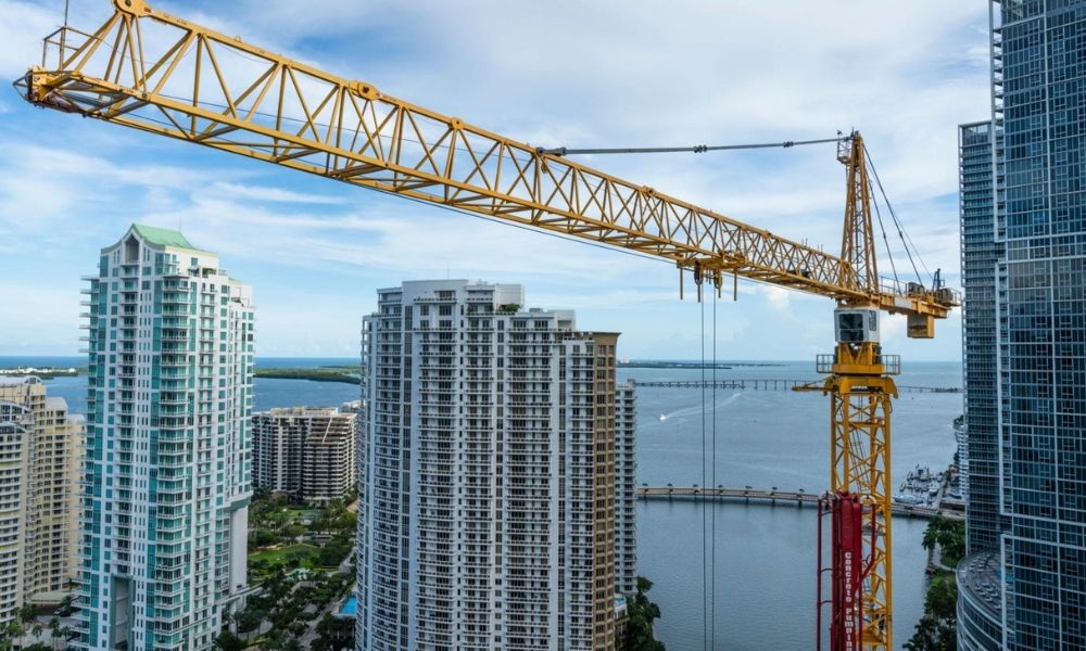
Miami keeps building. New towers rise in Wynwood and Brickell. Cranes fill the skyline. 

From the street, it looks easy. Buy land, get a loan, start building.

That’s not how it works.

Before any money moves, lenders slow everything down. They check the land first. They check the risks. They want facts, not assumptions.

That’s where an ALTA land survey comes in.

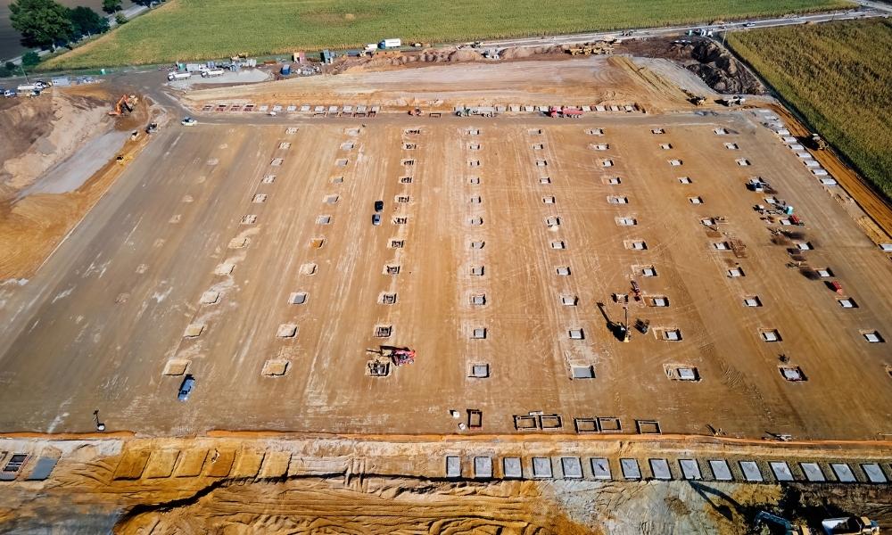
Miami land is not simple

Banks do not approve construction loans based on plans alone. They want proof that the site works in real life.

Miami makes this harder.

Lots are tight. Old records do not always match the ground. Access points can be unclear. Some parcels have changed over time.

So lenders ask for one thing before closing. They want a full survey that shows the real condition of the land.

That survey is the ALTA land survey.

Why lenders require an ALTA land survey

A construction loan is a big risk for a bank. They are not guessing where buildings sit or where lines run.

They want proof.

An ALTA land survey gives that proof. It shows what is real, not just what is written in documents.

Without it, lenders hesitate. Deals slow down or stop.

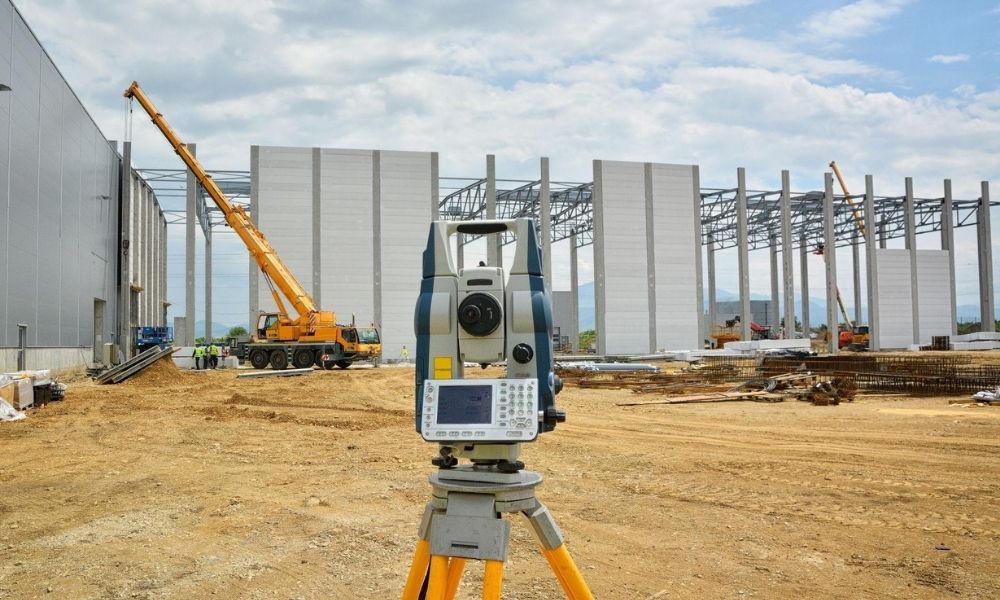
What the ALTA land survey shows

This survey checks more than boundaries.

It lines up records with actual site conditions. That matters in a city like Miami where things shift over time.

It shows:

  • Property lines based on legal records
  • Buildings already on the site
  • Driveways and access points
  • Utility easements
  • Encroachments from nearby properties

This is not guesswork. It is a clear view of the land as it exists today.

That clarity helps lenders move forward.

Where projects run into trouble

Deals don’t fall apart for no reason. They usually hit the same types of issues.

A wall crosses a property line. A fence sits in the wrong spot. A utility line cuts through part of the lot.

These are common in Miami.

When the survey finds them late, everything pauses. Plans must change. Teams go back to fix the issue.

That costs time. It costs money. It can delay closing.

Why timing matters more than people think

Some teams treat the survey like a final step. That is a mistake.

If you order it late, problems show up when the project is already moving.

Designs may be finished. Contractors may be ready. Then the survey shows something off.

Now you adjust everything. That delay hurts.

Teams that order early catch issues sooner. They fix them before plans are locked in.

That keeps the project moving.

Miami makes ai small mistakes expensive

ALTA land survey equipment set up on construction site with cranes and structural framing in progress
#image_title

In Miami, space is tight.

Buildings sit close together. Lots don’t leave much room for error.

Add older records into the mix, and you get gaps between what is written and what exists.

Zoning rules and flood limits add more pressure.

A small mistake here can stop a project fast. That is why accuracy matters so much in this market.

Title companies rely on the same data

Lenders are not the only ones checking.

Title companies also review the property before closing. They compare legal records with what the survey shows.

If something does not match, they raise it right away.

That can delay the deal or add conditions before approval.

A clear ALTA land survey keeps this part clean.

What smart developers do 

Experienced developers do not wait.

They order the ALTA land survey early. They review it with their team. They fix issues before final plans.

They check where the real boundaries sit. They confirm access. They look for anything crossing into the lot.

This step avoids problems later.

Skipping it or delaying it usually leads to trouble.

Projects keep moving, but the process stays strict

Miami will keep growing. New projects will keep coming.

But behind every project, the same process holds.

Lenders check risk. Title companies check records. Surveyors confirm what is on the ground.

The ALTA land survey ties all of that together.

Handle it early, and the project moves forward.

Ignore it, and delays show up fast.

Posted in land surveying | Tagged alta land survey, Land Surveying, land surveyor miami

Where LiDAR Mapping Helps Before Design Starts

Miami Land Surveying Posted on May 5, 2026 by MiamiLSMay 5, 2026

A site can look flat and ready. It rarely is.

LiDAR mapping gives you a clear view of the ground before design begins. It shows elevation changes, drainage paths, and hidden features so you can plan with real data instead of assumptions.

That early clarity helps avoid redesign, delays, and extra cost.

LiDAR mapping aerial view of a construction site showing graded soil, foundation layout points, and earthwork preparation for development planning
#image_title

What does LiDAR mapping show before design starts?

LiDAR mapping shows detailed ground elevation, drainage paths, and surface features before design begins. It helps identify slopes, low areas, and hidden conditions that affect grading, drainage, and layout. This allows engineers and developers to plan accurately and avoid costly changes later in the project.

LiDAR mapping uses a laser from a drone or aircraft. It scans the surface and builds a detailed model of the ground.

It shows more than outlines. It shows how the land actually moves.

You can see:

  • small elevation changes
  • natural drainage flow
  • dips where water collects
  • features under light vegetation

Even small height changes matter. Water follows them. So does your design.

Why does LiDAR mapping matter before design?

LiDAR mapping provides accurate site data early. This helps prevent redesign, reduces construction delays, and avoids added costs. When engineers understand the land from the start, they can create plans that match real conditions instead of adjusting later.

Most issues do not show up at the start. They appear after plans are finished.

Then changes begin. Costs rise. Timelines stretch.

LiDAR mapping shifts that timing.

You see the real site early. The design follows the land. You avoid forcing a plan onto conditions that do not support it.

That keeps progress steady and reduces rework.

When should you use LiDAR mapping on a project?

LiDAR mapping works best for large or complex sites where elevation, drainage, and access matter. It is useful when vegetation blocks visibility or when full site coverage is needed early. It helps developers, engineers, and property owners understand site conditions before planning begins.

It becomes useful when a site gets harder to read.

This includes:

  • large properties
  • new developments
  • long access routes
  • uneven or sloped land

Walking a site only shows parts of it. Some areas stay hidden or hard to reach.

LiDAR mapping captures everything at once. You get full coverage, not scattered points.

That leads to better planning decisions early.

How does LiDAR mapping help with drainage planning?

LiDAR mapping shows how water moves across a site. It identifies slopes, low areas, and flow paths that affect grading and runoff. This allows engineers to design proper drainage systems early and reduce the risk of flooding or standing water after construction.

Water shapes most site problems.

Rain does not need much space to cause issues. A small dip can hold water. A slight slope can direct it toward structures.

LiDAR mapping shows these patterns clearly.

You can find:

  • low spots that hold water
  • slopes pushing water in the wrong direction
  • areas that need grading work

This allows drainage planning to happen early, not after problems show up.

Why does LiDAR mapping reduce plan revisions?

LiDAR mapping provides accurate site data before design begins. Plans based on real conditions are less likely to require changes during review or construction. This helps avoid delays, reduces back-and-forth with reviewers, and keeps the project moving forward.

Plans must match the site.

If they do not, they come back with comments. Then revisions follow. Then more waiting.

LiDAR mapping reduces that cycle.

You start with better data. Plans match real conditions. That cuts avoidable corrections.

You still go through review, but with fewer surprises.

LiDAR mapping visualization comparing a real coastal development site with a digital elevation heatmap showing terrain changes, drainage patterns, and topographic variation
#image_title

Can LiDAR mapping see through vegetation?

LiDAR mapping can filter through light vegetation to reveal the ground surface. This helps identify elevation changes and hidden features that are not visible from above. It improves planning accuracy, especially on sites where trees or brush cover important ground conditions.

Vegetation hides detail.

A site may look simple because you cannot see the surface clearly.

LiDAR mapping can filter through lighter cover. It gives a clearer picture of the ground.

This helps with:

  • clearing decisions
  • building placement
  • access planning

You avoid hidden issues that show up later.

How does LiDAR mapping work with an ALTA Survey?

LiDAR mapping supports early planning, while an ALTA Survey confirms legal and boundary details later. LiDAR helps with design decisions such as grading and layout. An ALTA Survey verifies property lines, easements, and improvements for title and transaction purposes. Both are used at different stages of a project.

LiDAR mapping and an ALTA Survey serve different roles.

LiDAR mapping comes first. It helps shape early design decisions.

An ALTA Survey comes later. It confirms boundaries, easements, and recorded features tied to ownership and title.

Using both at the right time keeps the project aligned from planning to closing.

When is LiDAR mapping not enough?

LiDAR mapping is not enough when precise boundary, legal, or construction layout data is required. Projects still need boundary surveys, construction staking, and field verification. LiDAR provides surface data, but it does not replace detailed surveys needed for legal accuracy and construction execution.

LiDAR mapping shows surface conditions well.

It does not replace:

  • boundary surveys
  • construction staking
  • detailed field checks

Relying on it alone creates gaps.

Use it for early planning. Then move into the right surveys as the project advances.

How LiDAR mapping saves time early in a project

LiDAR mapping collects large amounts of site data quickly. This allows design work to begin sooner and reduces delays caused by incomplete information. Faster data collection helps teams make decisions earlier and move projects forward with fewer interruptions.

Time matters on every project.

Traditional surveys take longer on large or complex sites.

LiDAR mapping speeds up the early stage. Data comes in faster. Decisions happen sooner.

That keeps the project moving instead of waiting on missing information.

What happens if you skip LiDAR mapping?

Skipping LiDAR mapping can lead to design errors, drainage issues, and costly revisions. Without accurate early data, teams rely on assumptions. This often results in delays, added costs, and construction changes. Early mapping reduces risk by providing a clear understanding of the site from the start.

Skipping early mapping leads to guesswork.

Plans may look fine at first. Problems appear later.

You may deal with:

  • grading changes during construction
  • water issues after building
  • delays from revisions
  • added costs to fix mistakes

Most of this comes from missing site data.

What to Keep in Mind

The land already has a shape.

Your design has to follow it.

LiDAR mapping helps you see that shape early. That changes how you plan and how the project moves forward.

Skipping it does not save time. It only shifts the problems to a later stage, when they cost more to fix.

Posted in land surveying | Tagged alta land survey, Drone LiDAR mapping, land survey

What a Topographic Survey Means for Construction 

Miami Land Surveying Posted on April 23, 2026 by MiamiLSApril 23, 2026
Surveyor using GPS equipment for a topographic survey on a construction site

A construction project looks simple at first. A piece of land seems flat enough, and plans feel ready to go. Then problems show up once digging starts. Water does not flow the right way. The ground is uneven. A building design does not match the land. These issues often come from skipping one key step, the topographic survey.

A topographic survey shows the real shape of the land. It maps height changes, slopes, trees, roads, and anything built on the site. Because of this, engineers and builders can see what they are really working with before any design or construction begins. Without it, plans rely on guesses, and guesses can get expensive fast.

This is why a topographic survey plays a major role in construction and site design. It gives a clear picture of the land so projects can move forward with fewer surprises.

What a Topographic Survey Shows

A topographic survey measures the land in detail. It does not just show property lines. Instead, it shows the full shape of the ground.

Surveyors record things like hills, slopes, low areas, and flat sections. They also mark features such as roads, fences, buildings, trees, and drainage paths. In many cases, they use tools like GPS equipment, drones, or laser mapping to collect accurate data.

After the field work, all this data turns into a map. That map helps engineers understand how the land behaves. So, instead of guessing where water might flow or how soil will move, they can see it clearly.

This step becomes the base for every design decision that follows.

Why Construction Projects Depend on It

Construction projects depend on a topographic survey because land is never perfectly flat, even when it looks that way.

When builders skip this step, problems often show up later. A building may sit too low or too high compared to the road. Water may pool near foundations. Driveways may end up too steep or uneven.

With a topographic survey, engineers can plan around these issues early. They adjust building height, drainage paths, and grading plans before work begins. As a result, the project runs smoother and avoids redesigns.

It also helps with permits. Many cities and counties require accurate site data before approving construction plans. So having a topographic survey ready can speed up approvals and reduce delays.

How It Helps in Site Design

Civil engineer reviewing site plans and contour maps during a topographic survey for construction planning

Site design depends on accurate ground information. A topographic survey gives that information in a clear way.

For example, architects use it to place buildings in the safest and most stable areas. Engineers use it to design drainage systems so water flows away from structures. Road designers use it to plan smooth access points that match the slope of the land.

It also helps with utility planning. Water lines, sewer systems, and electrical routes all depend on ground levels. If the slope is wrong, systems may not work properly.

Because of this, the survey becomes the starting point for design. Without it, every design choice becomes a risk.

What Happens When It Is Skipped

Skipping a topographic survey can cause serious problems during construction.

One common issue is drainage failure. Water may flow toward buildings instead of away from them. This can lead to flooding or foundation damage.

Another issue is grading mistakes. Contractors may discover that the land is steeper or flatter than expected. This leads to extra excavation work and higher costs.

Design changes also become more likely. If the original plan does not match the land, engineers must revise drawings. This slows down the project and increases expenses.

In some cases, permits get delayed or rejected because the site information is not accurate enough. So what seemed like a small shortcut can turn into a major setback.

Who Needs a Topographic Survey

A topographic survey is not only for large construction companies. Many different people and projects need it.

Home builders use it before starting a new house. Developers use it for subdivisions and commercial sites. Engineers rely on it for infrastructure projects like roads and utilities. Even homeowners may need it before building retaining walls, driveways, or additions.

Any project that changes the land depends on understanding the ground first. Because of that, a topographic survey becomes a standard step in planning.

When You Should Get One

Timing matters. A topographic survey works best when done early in the project.

It should happen before design work begins. This gives architects and engineers accurate data from the start. It should also happen before permit applications, since many authorities require it.

In addition, it should be done before any grading or land clearing. Once the land is changed, the original shape is lost, and planning becomes harder.

When done at the right time, the survey saves both time and money throughout the project.

How Surveyors Create It

Surveyors start by visiting the site. They walk the land and collect measurements using GPS tools, laser scanners, or drones. These tools help capture small changes in elevation and surface detail.

After collecting data, they process it into a map or digital model. This model shows contours, which are lines that represent different heights on the land.

The final product may come as a digital file or printed map. Engineers then use it for design work and planning.

Even though the process sounds technical, the goal is simple. It turns real land into clear information that people can use.

Cost Factors to Expect

The cost of a topographic survey depends on a few things.

Large properties take more time to measure, so they cost more. Rough or wooded land also takes longer to survey. In addition, complex sites with many features require more detail, which adds to the cost.

Location can also affect pricing. Some areas need more detailed mapping due to regulations or terrain conditions.

Even so, the cost of a survey is small compared to the cost of fixing design mistakes later.

Topographic Survey Compared to Other Surveys

A topographic survey is often confused with other types of surveys, but they are not the same.

A boundary survey focuses on property lines. It shows where land starts and ends. A construction survey focuses on marking where structures will be built. A topographic survey focuses on the shape of the land itself.

Because of this, many projects use more than one type of survey. Each one serves a different purpose, but the topographic survey usually comes first in the planning stage.

Final Thoughts

A topographic survey gives builders, engineers, and designers a clear view of the land before work begins. It shows slopes, features, and elevation changes that are easy to miss at first glance. Because of that, it helps prevent design errors, construction delays, and unexpected costs.

When used early, it supports better planning and smoother projects from start to finish.

Without it, construction decisions rely on guesswork. With it, every step has a solid foundation built on real site data.

Posted in land surveying | Tagged Topographic surveys

Post navigation

← Older posts
Newer posts →
Get Quote Button

Select Your City

  • Aventura
  • Coral Gables
  • Cutler Bay
  • Doral
  • Hialeah
  • Homestead
  • Miami Beach
  • Miami Gardens
  • Miami Lakes
  • North Miami
  • North Miami Beach

The owner of this website, USA Surveying & Engineering, LLC., provides coordination of professional land surveying and engineering services in all 50 states. The professional surveying and engineering services provided to you will be conducted by fully licensed professionals in your state.

Privacy Policy | Terms of Use
↑