↓
 

Miami Land Surveying

Local Land Surveyors in Miami, FL

Miami Florida Land Surveying
(305) 376-7707
Miami Land Surveying
  • Home
  • ALTA Survey
  • Boundary Surveying
  • Construction Survey
  • Drone LiDAR Mapping
  • Elevation Certificate
  • Land Surveying
  • Topographic Survey
  • About Us
  • Blog
  • Contact Us
Home→Categories land surveying - Page 2 << 1 2 3 4 … 6 7 >>

Category Archives: land surveying

Post navigation

← Older posts
Newer posts →

How to Find Your Property Lines

Miami Land Surveying Posted on May 19, 2026 by MiamiLSMay 19, 2026
Survey plat map and property layout used to help find property lines and verify parcel boundaries during land planning

Before you break ground, you need to find your property lines. Not after permits. Not during construction. Before anything starts.

A wrong assumption about where your land ends can kill permits, delay closings and spark lawsuits that drag on for years. Most developers skip this step until it’s already a problem.

Here’s how to do it right.

What Are Property Lines?

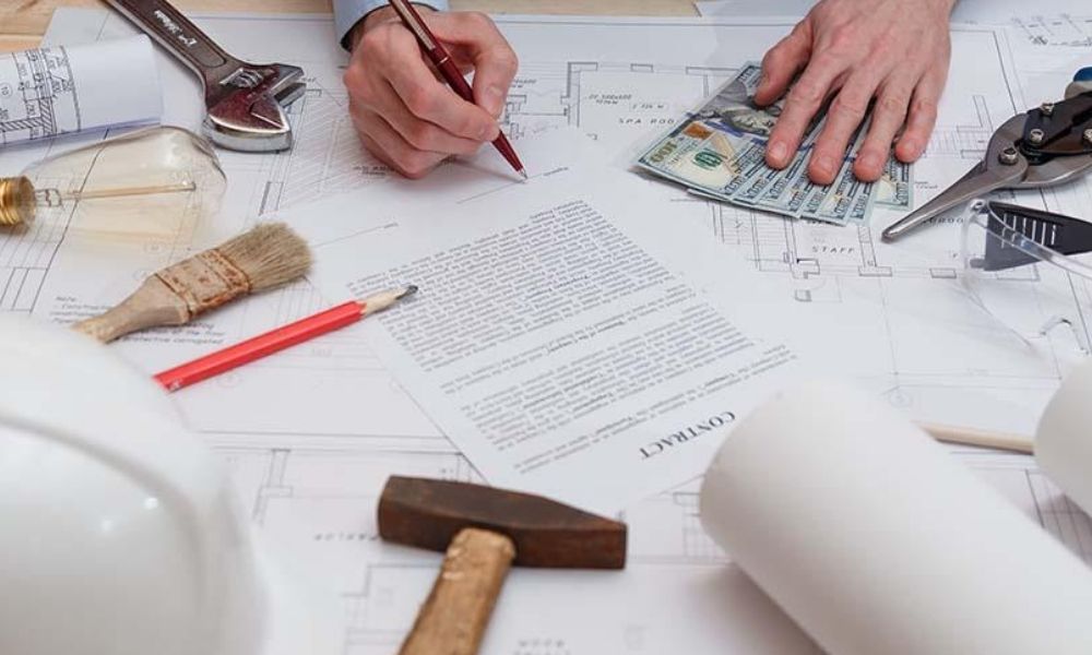
Property lines are the legal edges of your land. They control what you can build, where you can build it and how close you can get to the edge of your parcel. For developers, these lines affect setbacks, zoning compliance and easement restrictions. Getting them wrong doesn’t just mean paperwork problems. It can mean forced demolition.

4 Ways to Find Your Property Lines

There are four methods developers use to locate property lines. Each has a different level of accuracy, and only one holds up in court.

1. Start With Your Property Deed

Your deed contains the legal description of your land. That description is what a surveyor uses to locate your boundaries in the field.

Most legal descriptions use one of two formats:

  • Metes and bounds: traces the boundary using distances and compass directions from a starting point
  • Lot and block: points to a recorded plat map with assigned lot numbers

The deed alone won’t show a line on a map. But it’s the foundation for every method that follows. Get a copy from your county recorder’s office or title company.

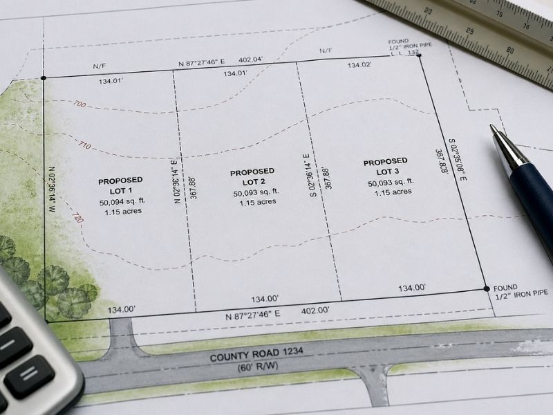
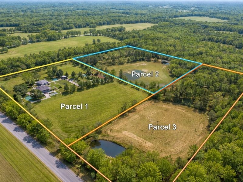
2. Pull the Recorded Plat Map

If your site is part of a subdivision, a plat map was recorded when the land was originally divided. That map shows lot dimensions, easements and rights-of-way for the entire subdivision.

You can usually find plat maps through:

  • Your county’s property appraiser website
  • The county clerk or recorder’s office
  • Your title insurance documents

Plat maps are a good starting point. They’re not reliable for field decisions, especially on older properties where monuments may be missing or shifted.

3. Look for Physical Survey Markers

When a boundary survey is completed, the surveyor sets physical monuments at each property corner. If those are still in place, they mark your actual boundary on the ground.

Common markers include:

  • Iron rods or pipes in the ground, sometimes capped with the surveyor’s license number
  • Concrete monuments flush with the surface
  • Survey stakes with flagging tape, usually from a recent active survey

Don’t assume every stake you find is accurate. Contractors and fencing crews disturb or remove them all the time. Always verify what you find with a professional before making any site decisions.

4. Use County GIS Mapping Tools

Most countries offer free online GIS tools that display parcel boundaries over aerial imagery. These are useful for a quick visual check during early planning.

But GIS maps carry a real margin of error. They’re digitized from older records and can be off by several feet. In older urban areas, that gap can reach 10 feet or more.

Use them for general reference. Never rely on them for legal or construction decisions.

Aerial property map showing parcel boundaries used to help find property lines and identify land divisions and lot layouts

When You Need a Licensed Surveyor

For any development project, a professional boundary survey is the only method that holds up legally. A licensed surveyor will research deed records and prior surveys for your parcel, locate existing monuments in the field, measure and calculate exact boundary positions, set new monuments where old ones are missing and produce a legal drawing you can submit to the county or lender.

If your project involves permits, financing or construction near a boundary, don’t skip this step. Most lenders require a survey before closing. Most building departments require one before issuing permits.

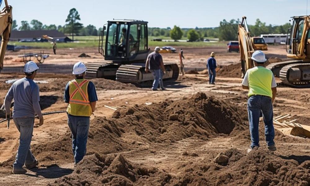
What Can Go Wrong Without a Survey

Developers who skip the survey tend to run into the same problems.

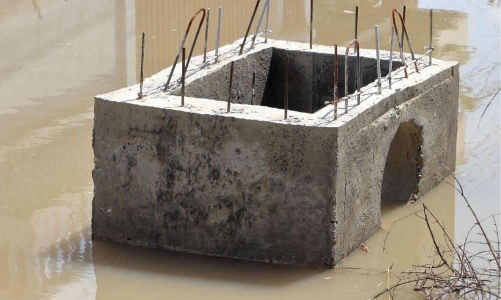
Encroachments. A structure, fence or paved area that crosses the line. This can kill a deal or force a costly removal after construction is done.

Setback violations. Without knowing your exact boundary, you can’t calculate setbacks correctly. A violation can stop a permit or require tearing down work you’ve already paid for.

Easement conflicts. Easements give others the legal right to use part of your land. Building on one creates serious legal exposure that won’t go away at closing.

Title problems. If your survey doesn’t match the deed description, your title coverage may not protect you.

Fixing any of these after construction costs far more than a survey would have before it.

Frequently Asked Questions

Can I find my property lines for free?

Partly. You can check your deed, pull a plat map or use a county GIS tool at no cost. But none of these give you a legally accurate boundary. For construction or disputes, you need a licensed land surveyor.

How accurate are online GIS maps for property lines?

GIS parcel maps are digitized from older records. In many counties, they can be off by 5 to 10 feet or more. They’re useful for planning purposes only.

What is a boundary survey?

A boundary survey is a professional measurement of your property’s legal limits. A licensed land surveyor researches deed records, locates monuments in the field and produces a legal drawing showing exact boundary positions.

How long does a boundary survey take?

Most residential boundary surveys take 1 to 3 weeks from the date of hire. Larger or more complex parcels take longer. Rush surveys are sometimes available for an added cost.

Do I need a survey if I already have a plat map?

A plat map shows the original recorded layout of a subdivision. It doesn’t reflect what’s physically on the ground today. For any development work, a field survey is still required to confirm current conditions.

Posted in land surveying | Tagged boundary survey, land surveying miami

What an ALTA Survey Includes vs. What Must Be Requested Separately

Miami Land Surveying Posted on May 8, 2026 by MiamiLSMay 5, 2026
Alta land survey documents reviewed during construction loan closing process
#image_title

When people order an ALTA survey, they expect everything to be covered.

That is not how it works.

An ALTA survey gives a strong starting point. It shows the shape of the land, what sits on it, and how it connects to nearby properties. It also checks legal records against real conditions.

But it only shows what is requested.

If something is not listed, it does not show up.

That is where problems begin.

What an ALTA Survey Includes

An ALTA survey follows a set standard. Lenders and title companies rely on it before closing.

At the base level, it shows:

  • Property boundaries
  • Buildings and visible structures
  • Easements that affect use
  • Access points like roads and driveways
  • Encroachments from nearby properties

It also compares recorded documents with what exists on the ground. If something does not match, it gets flagged.

This base survey helps confirm that the property matches its legal description.

Still, it does not cover every detail.

Why the Base Survey Is Not Enough

No two properties are the same.

Some sites are simple. Others have shared access, unclear records, or limits that affect how the land can be used.

A basic ALTA survey may not show:

  • Flood zone classification
  • Utility locations
  • Zoning details
  • Parking layout

These details matter.

Flood zones affect insurance. Zoning affects what you can build. Utilities affect whether a project can move forward.

If these are not included, the survey leaves gaps.

Those gaps usually show up late.

That slows everything down.

What Must Be Requested Separately

Extra details come from the ALTA Table A Items List.

This list includes optional survey items. Each one adds a layer of information to the survey.

Common examples include:

  • Flood zone classification
  • Zoning information
  • Utility locations
  • Parking spaces and layout
  • Building heights and dimensions
  • Access points and curb cuts
  • Signs of shared use like driveways or paths

Each item must be selected before the survey begins.

Surveyors follow the request. They do not add items on their own.

If something is not listed, it will not appear in the final survey.

Why Table A Items Matter

These optional items often decide how smooth a deal will go.

Take access.

A property may look like it connects to a public road. The survey may show that access crosses another parcel. That creates a legal issue that needs to be addressed.

Now think about utilities.

A site may look ready for development. Then the survey shows no clear utility connection. That can stop a project.

Flood zones cause issues as well.

If a property sits in a flood zone, insurance costs can change fast. Lenders need that information before approving a deal.

These are not small details.

They affect cost, timing, and approval.

Where Requests Go Wrong

Most problems start early.

Buyers assume the survey includes everything. Lenders expect certain details but do not always list them clearly.

That creates gaps.

The survey gets completed, and missing details show up later.

Now the survey needs updates.

That means more time and more cost.

It also creates pressure close to closing, where delays hurt the most.

How to Request the Right Survey

The request should match the goal of the project.

A development site needs more detail. A simple purchase may need less.

Still, some items come up often:

  • Flood zone data
  • Access confirmation
  • Utility locations
  • Zoning information

These protect both the buyer and the lender.

It is better to include them early than fix missing pieces later.

The Role of the Surveyor

A surveyor follows the scope that is given.

They do not decide which Table A items to include. That choice comes from the client, lender, or title company.

A good surveyor will still point out gaps when they see them.

They have seen deals slow down because of small missing details.

That experience helps avoid repeat work.

Why This Matters Before Closing

Timing matters.

An ALTA survey often comes near the end of a deal. If something is missing, there may not be enough time to fix it without delay.

That is why the scope must be clear from the start.

A complete survey answers questions early. It reduces surprises and keeps the deal moving.

When the scope is weak, the opposite happens.

Get the Scope Right From the Start

An ALTA survey only shows what is requested.

The base covers key details. The rest depends on the ALTA Table A Items List.

If the scope is clear, the survey works.

If not, problems show up late.

Most delays do not come from the survey itself.

They come from missing details at the start.

Posted in land surveying | Tagged alta land survey, alta land table A, land survey, Land survey requirements, land surveying miami

What a Topographic Survey Shows

Miami Land Surveying Posted on May 7, 2026 by MiamiLSMay 6, 2026
 Topographic survey guiding site grading work with construction crew and heavy equipment on land development site
#image_title

You walk on a property for the first time. It looks flat. Clean. Ready to build.

That first look can fool you.

The ground always tells a different story. Small dips, slight slopes, and hidden paths for water shape how your project will go. You just can’t see them at eye level.

A topographic survey shows the real shape of the land before any grading starts. It maps elevation, slopes, and drainage so engineers can plan safely and avoid costly mistakes.

What Does a Topographic Survey Show Before Grading?

A topographic survey shows elevation changes, slopes, drainage paths, and surface features on a property. It helps engineers understand how the land behaves before grading begins, so they can plan building placement, drainage, and site work with accurate data.

The ground is never truly flat.

Most people think flat land means easy construction.

That is not how it works.

Even a few inches of height change can shift water flow. Rain follows the lowest path, even if that path is hard to notice.

On a raw site, those small changes control where water collects, how soil moves, and how stable your building area will be.

Without clear data, grading becomes guesswork. And guesswork leads to problems later.

What Does a Topographic Survey Measure?

A topographic survey measures elevation and maps the shape of the surface. It collects points across the site to show slopes, high and low areas, drainage paths, and existing features.

Surveyors collect points across the site. Then they connect those points to show elevation changes.

From that, you get a clear picture of:

  • high spots and low spots
  • slopes across the land
  • natural drainage paths
  • existing features like trees, fences, and driveways

This map becomes the base for every design decision that follows.

No survey means no real understanding of the ground.

Why Is a Topographic Survey Needed Before Grading?

A topographic survey is needed before grading because it shows how water flows and where elevation changes exist. Without it, grading may direct water toward structures, create uneven surfaces, or cause soil movement after construction.

Grading shapes the land so water moves the right way and structures sit on stable ground.

It sounds simple. It is not.

If you grade without a topographic survey, you risk:

  • sending water toward the house
  • flooding driveways or patios
  • creating uneven surfaces
  • causing soil to shift after construction

Each of these problems costs time and money to fix.

With a survey, engineers design grading that works with the land instead of forcing it.

How Does a Topographic Survey Help Drainage Planning?

 Topographic survey showing drainage structure and water flow conditions on construction site to prevent flooding issues
#image_title

A topographic survey helps drainage planning by showing where water flows, where it pools, and where it exits the property. This allows engineers to design grading that moves water away from structures and prevents flooding.

Water is always the main issue.

On paper, a site may look fine. On the ground, water may already have a path. You just don’t see it yet.

A topographic survey shows:

  • where water flows during rain
  • where it slows down or pools
  • where runoff exits the property

If grading ignores these patterns, water will find its way back.

What Problems Happen Without a Topographic Survey?

Without a topographic survey, builders may miss small elevation changes that affect drainage and stability. This can lead to flooding, erosion, uneven grading, and costly repairs after construction begins.

This is where most mistakes happen.

A difference of two or three inches might not look like much. Still, it can change everything.

That small drop can:

  • direct water toward your foundation
  • push runoff into a neighbor’s lot
  • cause erosion along edges of the site

Once construction starts, fixing these issues becomes harder.

Catching them early is easier and cheaper.

What Do Builders Miss Without Survey Data?

Builders without survey data often miss subtle slopes, low areas, and uneven ground. These hidden issues affect foundations, drainage, and grading quality, and they usually appear only after work begins.

Some builders rely on visual checks or rough measurements.

That approach works until it doesn’t.

Without a topographic survey, they miss:

  • subtle slopes across the lot
  • low areas hidden by grass or fill
  • old grading patterns from past use
  • uneven ground that affects foundations

These details do not show up until grading begins. By then, changes slow everything down.

How Does a Topographic Survey Guide Design?

A topographic survey guides design by giving engineers accurate ground data. It helps them place structures, plan slopes, and set elevations so the site drains properly and stays stable.

A topographic survey does more than show problems. It helps shape better plans.

Engineers use it to:

  • place the building at the right height
  • design slopes that move water away
  • plan driveways with smooth transitions
  • set finished floor elevations

Each decision depends on real ground data.

That is how projects stay on track.

Why Should You Get a Topographic Survey Early?

Getting a topographic survey early helps avoid delays, redesign, and permit issues. It ensures plans are based on real site conditions from the start.

Waiting too long creates risk.

Some projects start design first. Then they check the land later.

That flips the process.

When survey data comes in late, plans often need changes. That leads to delays, redesign costs, and permit issues.

Getting the survey early keeps everything moving forward without surprises.

What Changes After You See the Survey?

After reviewing a topographic survey, you can see elevation lines, drainage patterns, and how the land behaves. This makes planning easier and reduces guesswork.

Once the survey is complete, the site looks different.

Not physically, but on paper.

You see where water will go before it ever rains.

That clarity changes decisions.

Why a Topographic Survey Saves Money

A topographic survey saves money by preventing grading errors and drainage problems. Fixing issues after construction costs more than planning correctly from the start.

Skipping it may seem like a way to save money.

It usually does the opposite.

Water damage, regrading, and repairs add up fast.

A survey helps prevent those problems from starting.

The Real Value Before Grading Begins

Before any machine touches the ground, you need to understand it.

A topographic survey gives you that understanding.

It shows what your eyes cannot see. It reveals how the land behaves. It guides every grading decision that follows.

That is how projects stay smooth, stable, and on schedule.

Posted in land surveying | Tagged miami topographic survey, topographic survey

Post navigation

← Older posts
Newer posts →
Get Quote Button

Select Your City

  • Aventura
  • Coral Gables
  • Cutler Bay
  • Doral
  • Hialeah
  • Homestead
  • Miami Beach
  • Miami Gardens
  • Miami Lakes
  • North Miami
  • North Miami Beach

The owner of this website, USA Surveying & Engineering, LLC., provides coordination of professional land surveying and engineering services in all 50 states. The professional surveying and engineering services provided to you will be conducted by fully licensed professionals in your state.

Privacy Policy | Terms of Use
↑