
An Elevation Certificate for Buildings With Enclosed Parking
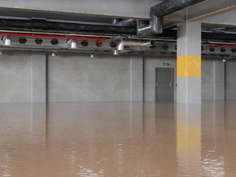
A building with enclosed parking looks solid and dry from the street. Below the living floors sits a garage, walled in and often close to ground level. That lower level changes how flood risk gets measured, and many owners never realize it. An elevation certificate helps document how the lower portion of the structure relates to surrounding flood conditions and provides important information for insurance, permitting, and future property decisions.
An elevation certificate is where those details get recorded. Enclosed parking adds questions a simple form does not answer on its own. Get the certificate wrong, and you could face a higher insurance premium or a permit problem you did not expect. Get it right, and you have proof of how your building sits against flood risk.
Here is the takeaway. An elevation certificate for a building with enclosed parking must document that lower level carefully. Those details affect your flood insurance, your permits, and your records. The sections below explain what the certificate captures and why enclosed parking needs special attention.
Why Enclosed Parking Affects Elevation Documentation
An elevation certificate is a form completed by a licensed surveyor. It records how a building sits compared to the expected flood level in its area. This building elevation information helps show the height of important structural features and allows insurance companies and local officials to better understand flood risk..
Enclosed parking complicates that picture. An enclosed area sits below the main living space and is walled on all sides. When that area falls near or below the flood level, it changes how the building is rated. The surveyor has to document it clearly rather than treat it like a normal floor.
The lower level also raises the question of flood openings. These are vents built into enclosed walls that let water flow in and out during a flood. Their presence, size, and height all affect the certificate. A surveyor records these details so the building is documented accurately.
Reviewing Building Elevations and Flood Zone Requirements
Every elevation certificate starts with the flood zone. The surveyor confirms which zone the building sits in using the official flood maps. That zone sets the rules for what elevations matter and how they are measured. Understanding the official flood maps helps ensure the certificate captures the information needed for insurance reviews, permitting decisions, and accurate building documentation.
Next come the building elevations themselves. The surveyor measures key heights and records them on the form. For a building with enclosed parking, these measurements often include several points:
- The lowest floor, including the enclosed parking level
- The next higher floor above the enclosure
- The base flood elevation for the site
- The height of any flood openings
- The ground elevation next to the building
These numbers tell the real story of flood risk. If the enclosed parking sits below the expected flood level, that fact shapes the whole certificate. Flood zone rules and required elevations can vary by property, county, and city, so confirm what applies to your building early.
Documenting Enclosed Areas and Structural Features
The enclosed parking area gets its own careful review. The surveyor records its size, its floor elevation, and how it connects to the rest of the building. This detail separates a proper certificate from a rushed one.
Flood openings are a key focus here. The surveyor notes whether the enclosure has them, how many, and how high they sit. These openings matter because they affect how the building handles rising water. Their details feed directly into the insurance rating.
The surveyor also documents how the space is used and built. An enclosed area meant only for parking, storage, or access is treated differently from finished living space. Walls, machinery, and equipment locations may be recorded too. All of this creates an accurate record of the lower level and how it relates to flood risk.
Coordinating Elevation Data With Insurance And Permits
An elevation certificate does its real work once the data reaches the right hands. Insurance companies use it to set flood premiums. The measurements on the form can raise or lower what you pay, so accuracy matters to your wallet.
Local officials use the certificate too. Building departments often require one for new construction, major changes, or permits in a flood area. The form proves the building meets local flood rules. Without it, a permit or a closing can stall.
Enclosed parking makes coordination even more important. The lower level can trigger extra requirements from insurers or officials. Requirements can vary by property type, lender, insurance carrier, county, and city. If your timing depends on insurance, a permit, or a closing, order the elevation certificate early so the details are settled before deadlines hit.
Reducing Flood Risk Through Accurate Building Records
Flood risk is hard to manage when your records are wrong or missing. An owner who guesses about their building’s elevation can end up underinsured or out of compliance. An accurate elevation certificate replaces that guesswork with measured facts.
Good records protect you in plain ways. They support a fair flood insurance rate based on real elevations. They help you meet local rules and clear permits. They give buyers, lenders, and officials a reliable record when questions come up.
Treat the elevation certificate as a core document for any building with enclosed parking. Have a licensed surveyor prepare it and keep it with your property records. That one form can save you from surprise costs and give you a clear picture of how your building stands against flooding.
Frequently Asked Questions
What is an elevation certificate?
An elevation certificate is a form that records how a building sits against the expected flood level. A licensed surveyor measures the building’s key elevations and confirms its flood zone. Insurance companies and local officials use it to judge flood risk. It is a common requirement for buildings in or near flood areas.
Why does enclosed parking matter on an elevation certificate?
Enclosed parking sits below the main living space and is walled on all sides. When that level falls near or below the flood level, it changes how the building is rated. The surveyor must document its floor elevation and any flood openings. These details affect both your insurance and your compliance with local rules.
What are flood openings and why are they recorded?
Flood openings are vents in enclosed walls that let water flow in and out during a flood. They help lower pressure on the walls when water rises. A surveyor records whether they exist, how many there are, and how high they sit. These details factor into the elevation certificate and your flood insurance rate.
Does an elevation certificate lower my flood insurance?
It can, depending on how your building sits against the flood level. An accurate certificate makes sure your rate reflects your real elevations rather than an estimate. In some cases that means a lower premium, and in others it confirms the risk. Whether it helps varies by building, carrier, and flood zone.
When do I need an elevation certificate?
You may need one for flood insurance, a permit, or a real estate closing in a flood area. New construction and major building changes often require a current form. Buildings with enclosed parking can trigger extra scrutiny, so timing matters. Order the certificate early if a deadline depends on it.
