
A Construction Surveyor Can Track Work Across Several Phases
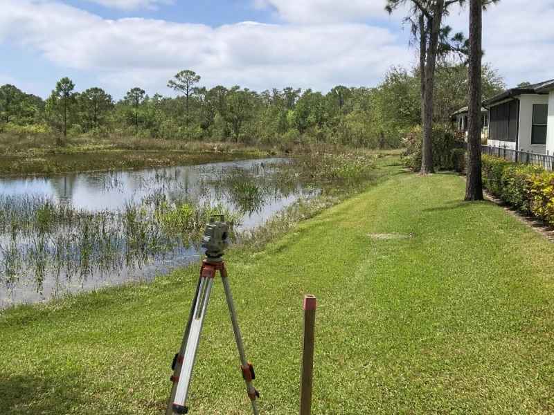
Big projects rarely get built all at once. They go up in stages, over months or years. Each stage has to match the one before it. If the stages drift apart, the parts won’t line up. A construction surveyor keeps them tied together.
A construction surveyor checks that field work matches the design plans. They stake out where things go and confirm they were built right. They track lines, grades, and heights at every step. On a phased job, that tracking runs from start to finish.
Plan for this from day one. A project built in phases has more chances to go off track. A shared set of survey points holds it all in place. Good survey work keeps each phase clean and the whole site correct.
One Survey Framework Across Multiple Construction Phases
Every phased project needs one shared base. That base is called survey control. It is a set of fixed points used to measure everything on site. Each phase is built from those same points.
Think of control as the anchor for the whole job. Phase one uses it. So do phases two and three. This keeps each stage in the right spot next to the others.
A construction surveyor sets and guards these points. They place markers at safe spots around the site. They check them often, since machines and weather can move or bury them. Lost control leads to errors that spread across phases.
Here’s what one shared framework gives a phased project:
- Every phase measured from the same base
- Fewer gaps where new work meets old work
- A fast way to reset if a marker is lost
- Clean records to pass from phase to phase
Ask your surveyor how control will hold up over a long build. Confirm who checks it and how often. This keeps small errors from growing over time.
A Construction Surveyor as the Link Between Design and Field Progress
Plans and dirt are two different things. The design looks perfect on paper. The site has slopes, soil, and existing work to deal with. A construction surveyor connects the two.
They take the numbers from the plans and mark them on the ground. This is called staking or layout. The crew builds to those marks. This keeps the field work true to the design.
They also check work as it goes up. After a pour or a grade, the surveyor confirms it sits right. Small errors caught now are cheap to fix. The same error found later can cost a lot.
On a phased job, this link never breaks. The surveyor guides each stage as it starts. They flag drift before it reaches the next phase. That steady check protects both the budget and the schedule.
Phase Changes That Require Fresh Position and Elevation Checks
Each new phase is a fresh start that must match the past. The ground may have shifted since the last stage. Stakes may be gone. A construction surveyor runs new checks before the next phase begins.
Position checks confirm where things sit. The crew re-marks corners, lines, and building spots. They tie the new work back to the site control. This keeps the new phase aligned with the old one.
Elevation checks confirm the heights. Elevation is the height of a point against a set reference. New pads, roads, and pipes all have target heights. The surveyor checks them so water and traffic flow right.
Soft or wet ground can shift over time. In low coastal areas, settling is a real concern. A spot that was correct last year may have moved. Fresh checks catch this before it causes trouble.
Weather can change a site too. Heavy rain can wash out grades and hide markers. Storms can bury or move control points. A quick survey at the start of a phase clears up any doubt.
Keeping Buildings, Utilities, and Site Improvements Tied to the Same Control
A finished site has many parts. Buildings, roads, parking, and pipes all share the land. Each part must fit with the rest. The same survey control keeps them all in line.
Buildings must sit in the right spots and heights. A walkway between two of them has to meet both ends. If one building is off, the link between them fails. Tying each to the control prevents this.
Utilities need the same care. Water, sewer, power, and storm lines cross the whole site. Many run underground and connect across phases. The term alignment means each line follows its planned path and depth. Shared control keeps these lines from clashing.
Site improvements round out the work. Curbs, drains, and paving all rely on correct grades. Drainage is a big deal on flat, low sites. Poor grades cause pooling and worse. Drainage rules vary by county and project, so confirm the local standard early.
When every part ties to one control, the site works as a whole. Water drains as planned. Roads meet cleanly. Buildings line up the way the design intended.
Survey Records That Help Close Gaps Between Early and Final Work
Long projects build up a paper trail. Good survey records keep that trail clear. They show what was built, where, and at what height. These records close the gap between early and final work.
An as-built survey is a key record here. It maps the finished work as it truly sits in the field. This is especially useful after paving, drainage work, or other completed changes, where as-built survey after site improvements can document how the finished work actually sits. This can differ a little from the original plan. Later phases need the real picture, not just old drawings.
Records also help long after the build. Owners use them for repairs, add-ons, and new phases. Utility maps help crews dig safely down the road. These files are worth keeping in a safe, shared place.
Before a phase closes, confirm what records you need. Ask your construction surveyor for as-built data and updated control. Check what your lender or city may want as well. Record needs vary by project scope and municipality, so plan for them early.
A clear set of records protects everyone involved. It settles questions about what was built and when. It gives the next crew a solid start. And it leaves the owner with a true map of the finished site.
